Bluetooth offers low-cost, energy-efficient and easy to deploy indoor positioning and tracking technology. This helps to easily locate or track items and people, find directions and other important information within buildings and facilities such as airports, shopping malls, etc.
Usually, the location information has the potential to open up other opportunities. For example, it can be integrated with others, such as IoT, analytics, and others to trigger specific actions based on a user or object’s locations. Typical use cases include sending personalized messages to the users, powering an HVAC system, sending custom marketing information, etc.
The benefits of using Bluetooth include its low cost, high energy efficiency, working independently of the network, less interference, easy to deploy and integrate into the Bluetooth ecosystem, and more.
Why is indoor navigation necessary?
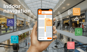
The indoor navigation is similar to providing visitors to a facility with a map that shows the location of anything on their phone’s screens. The technology has the potential to power smart buildings, improves navigation and reduces time wasting when finding items. It also gives the business owners the opportunity and ability to serve location-based content and advertising.
Typical deployments to assist visitors navigate their way inside buildings involve adding Bluetooth beacons to the areas of interest. Some use cases include;
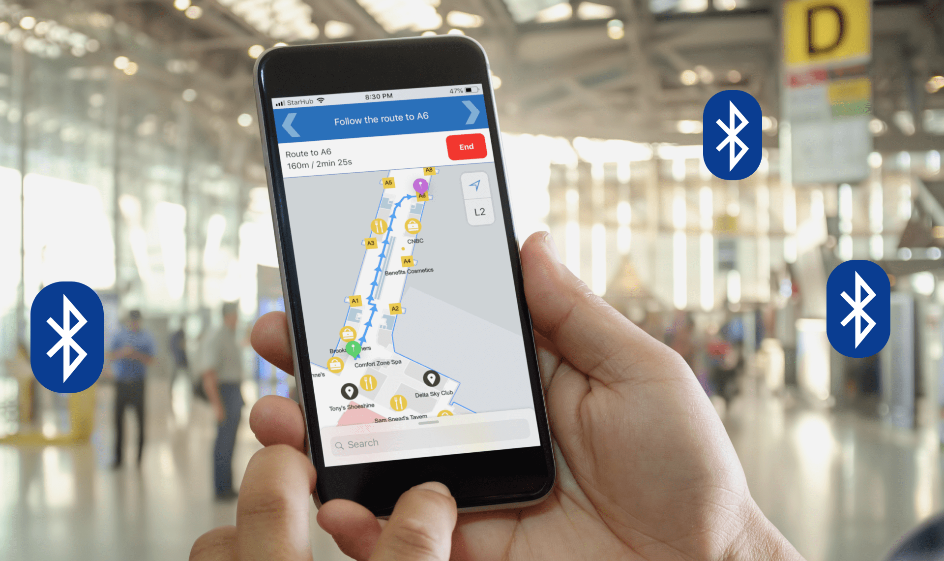
- Airports: users with the location services smartphone app can navigate easily while getting information such as the nearby check line, distance to a gate, boarding time, and more. The real-time asset tracking makes it easier to locate luggage, wheelchairs, and other items.
- Shopping malls, the businesses can use the BLE beacons to send notifications about discount coupons and special offers when customers approach the products under promotion.
- Museums: the technology allows the visitors to navigate through different sections and can provide maps and audio guidance hence improves the user experience. Also, the positioning allows location triggered content.
Different types of indoor positioning technologies
There are different indoor positioning technologies, including Bluetooth Low Energy (BLE), Wi-Fi, Magnetic field detection, Near Field Communication (NFC), ultra-wideband (UWB), and more. These often differ in terms of cost, effort, accuracy, and compatibility.
The Bluetooth positioning technology provides accuracy down to the meter or centimetre-level depending on configuration and enhancements. As such, it is more suited for applications that do not require precise locations. Basically, this technology has the potential to deliver satisfactory results and its cost and ease of deployment make it an ideal choice for most applications.
How Bluetooth location services work
The indoor positioning relies on Bluetooth Low Energy (BLE) beacons mounted on objects, walls, ceilings, and other places from where they emit radio signals at predetermined intervals. Devices within the emission area can then detect the signals and this helps to establish if the two (emitter and receiver) are within the range of each other.
Although one beacon is sufficient in establishing the presence of an object, it cannot pinpoint the specific location. Usually, the location accuracy increases with the number of beacons. After establishing that two objects are near each other, the Bluetooth location services can use the Received Signal Strength Indicator (RSSI) to estimate the distance between them.

Usually, the BLE beacons do not have inbuilt location intelligence but have standard protocols that determine what the beacon transmits. For example, common protocols such as iBeacon and Eddystone transmit the beacon’s unique IDs. Also they transmit power and other identifiable information.
A typical deployment involves assigning physical coordinates to the beacons in an external database or inside a mobile app. This ensures that the values the beacons transmit are converted to real-world coordinates. Comparing the signal values, coordinates from the beacons and RSSI makes it possible to estimate the rough position of a device.
RSSI is a representation of the power of the signal from the beacon. The value is low when the distance is long and higher if nearer. Some systems use the trilateration to improve accuracy. As the name suggests, trilateration requires a minimum of three beacons (known distances) to establish the exact position.
Different indoor positioning applications
The ability to determine the distance between two objects enables the development of other related applications that fall into two major categories; the proximity and positioning solutions.
Proximity solutions
Proximity solutions include the Point of Interest (PoI) where businesses can use location to push custom marketing information based on a user’s position. The other component of proximity solutions is the item finding that allows users to locate misplaced items.
Point of interest
Beacons and receivers are distributed throughout the facility at strategic points to ensure that all spaces are covered. When visitors, with Bluetooth devices, approach specific areas, the system will determine their locations and consequently send relevant information to smartphones.
For example, in a retail establishment, visitors can receive more product information whenever they are near specific shelves. For this to work, the visitors will need to install the smartphone app that listens to the broadcasts from nearby beacons as the customer walks. Once the proximity solution determines the visitors’ position, it can send the product information based on the nearby beacon.
Item finding
This involves adding identifiable Bluetooth tags to keys, wallets, medical devices, tools and other items that people often misplace. Users then install location services apps on their phones which they can launch when looking for the lost items.
In a typical deployment, the personal property tags will broadcast their location at regular intervals. The smartphone app listens to the tags and then determines the nearest location based on the estimated distance of the specific tag.
Positioning solutions
Indoor positioning solutions include the real-time locating systems RTLS for asset tracking and Indoor positioning system for wayfinding.
Real-time locating systems RTLS
Real-time tracking applies to both people and assets at factories, warehouses, and other facilities. The process involves adding location receivers throughout the facility and then attaching the Bluetooth tags to the assets or workers.
Because of the larger space and scale, an ideal setup is a server-based configuration in which there are several access points distributed throughout the building. The access points or nodes listen to all the tags after which they send the location information to a central server. In practice, the receivers will report to the location engine about all the assets it can hear, including their RSSIs.
The location engine then uses the received information, RSSI and the known locator position, to determine the location of the tagged asset. If an asset moves from one place to another, the system will be able to track it together with its movement as well as destination, as long as it is within the covered range.
This works the same for employees and can determine if they are spending time at their workplaces or elsewhere. The RTLS can also track tools such as forklifts, trolleys, medical devices, patients, workers and is useful in ensuring safety during emergencies.
A real-time asset tracking allows organizations to improve the product or object routing, as well as optimizing the running times and identifying maintenance requirements early based on the flow.
Other benefits of tracking assets in real-time include:
· Improving asset and inventory management with the ability to maintain real-time stock
· cutting costs
· reducing thefts
· Improving security and employee safety
· preventing accidents
· improving efficiency, maintenance prediction and reducing downtimes
Indoor positioning systems (IPS) — Wayfinding
Bluetooth IPS is a wayfinding technology that helps visitors to navigate through large and complex buildings such as malls, museums, hospitals, airports, and other facilities. In particular, it can assist or guide the visitors to find the right directions to their areas of interest.
Usually, IPS works differently from the RTLS system. The Bluetooth locator beacons or transmitters are mounted on fixed places throughout the facility. Unlike the RTLS where they are on moving targets. The users then have the smartphone apps that listen to the radio signals from the fixed locator beacons as they move inside the building.
Using trilateration, RSSI, and the location information they hear from the beacons, the apps calculate the user’s current position, compare with saved values and then direct users to where they want to go.
Source: Amos Kingatua for Medium